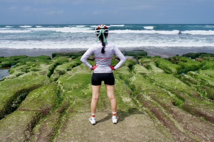
This post is on the branch routes and circular routes along Cycling Route No. 1. We have another post on doing the typical around-the-island ride in 9 days along Cycling Route No. 1.
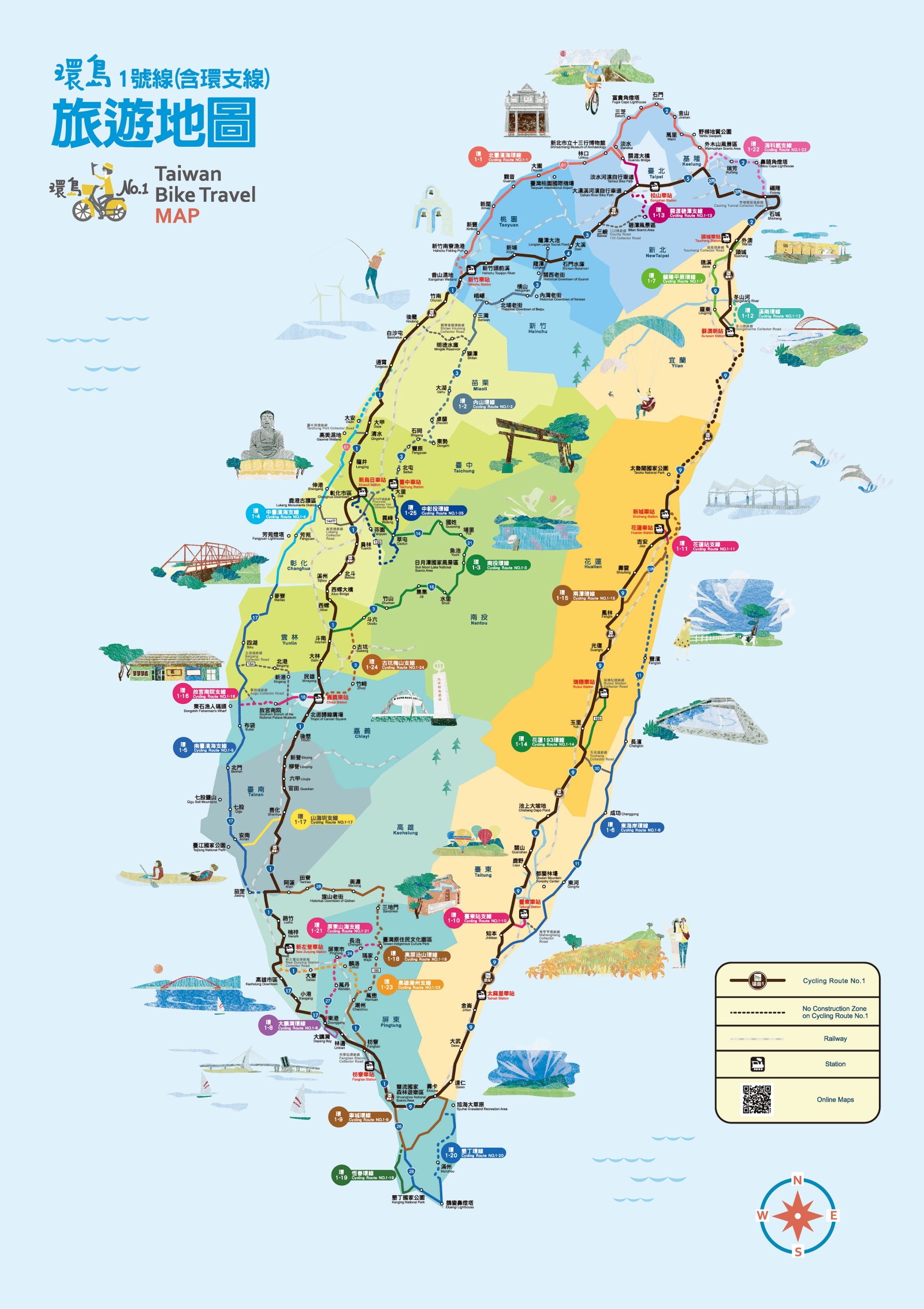
Click on the circular markings on the map for detailed info and GPX files for each day, or
Click here for a day-to-day list
- 1-1 North Taiwan Coastal Circular Route
- 1-2 Provincial Highway 3 Circular Route
- 1-3 Nantou Circular Route
- 1-4 Central Taiwan Coastal Branch Route
- 1-5 South Taiwan Coastal Branch Route
- 1-6 East Coast Circular Route
- 1-7 Lanyang Plain Circular Route
- 1-8 Dapeng Bay Circular Route
- 1-9 Checheng Circular Route
- 1-10 Taitung Station Branch
- 1-11 Hualien Station Branch Route
- 1-12 Xi’nan Circular Route
- 1-13 Guandu-Bitan Branch Route
- 1-14 Hualien County Road 193 Circular Route
- 1-15 Two-Lake Circular Route
- 1-16 Southern Branch of the National Palace Museum Branch Route
- 1-17 Mountain to Sea Branch Route
- 1-18 Kaohsiung-Pingtung Hillside Circular Route
- 1-19 Hengchun Circular Route
- 1-20 Kenting Circular Route
- 1-21 Pingtung Mountain to Sea Branch Route
- 1-22 National Museum of Marine Science and Technology Branch Route
- 1-23 Kaohsiung-Chaozhou Branch Route
- 1-24 Gukeng-Meishan Branch Route
- 1-25 Taichung-Changhua-Nantou Circular Route
Remarks
- Details of each route are linked to the map so that you can have a better idea of the location of the routes.
- The downloadable GPX files on the Taiwan Bike Single Portal cannot be imported to Garmin directly. We fixed them with GPSvisualiser and import them to connect.Garmin.com. You can use the links we provided to get the routes.
- We shorten the name of the routes so that it can be displayed better on the small screen of the Garmin or other GPS devices. For example, Cycling Route No. 1-15 is shorten to CR1-15.
- The website connect.Garmin.com and the App Connet by Garmin has Reverse Direction function in the route edit mode. If you need to travel in the opposite direction, you can reverse the direction of the course before loading it to your device.
- If you don’t use a Garmin but would like to follow the routes, you can use Velodash on your smartphone for navigation. The direction reversal function is not available for an imported route. But it is not necessary as the Velodash does not provide turn by turn navigation hitherto. Just follow the line on the map when you are cycling.
- The GPX routes and the routes shown on the maps are not exactly the same. In some cases, the staring point, ending point and some supply stops of a route on the map may deviate from the GPX route for 50 metres or more. Please fine tune the routes to suit your itinerary.
- We also have a day-to-day plan with our suggestions and alternative routes for doing the around-the-island in 9 days along Cycling Route No. 1.
Disclaimer
We DO NOT own the graphic and information in this post – it all came from the Taiwan Cycling Single Portal built and maintained by the Ministry of Transportation and Communications of the Taiwan Government. This website is the authoritative source of information for all those who plan to do the around-the-island trip in Taiwan. It’s very useful, but unfortunately not very user-friendly in our opinion. Therefore, what we are trying to do here is to re-organize the information in a way that we find handy and mobile-friendly.
More on the around-the-island tour

Cycling Around Taiwan in Multiple Stages (4): Taipei, Fulong, Fuguijiao
Continue your staged Taiwan cycling trip in northern Taiwan. Ride coastal roads or take optional Yangmingshan climb and return to Taipei via riverside paths.

Cycling Through Taiwan: A Seasonal Weather Guide
We have a lot of customers asking about the weather in Taiwan. Here I would like to share with you a brief idea of the climate of the island.

Speed Up on the West Coast – A Strategy to Cover the West when Cycling Around Taiwan
Ride a quieter West Coast route on your Taiwan cycling trip with splendid sea views and the flexibility to cover 200+ km daily. Perfect for speed enthusiasts