Route Overview
Total distance 65.3 km | Total ascent 776.42 m | Total descent 833.79 m
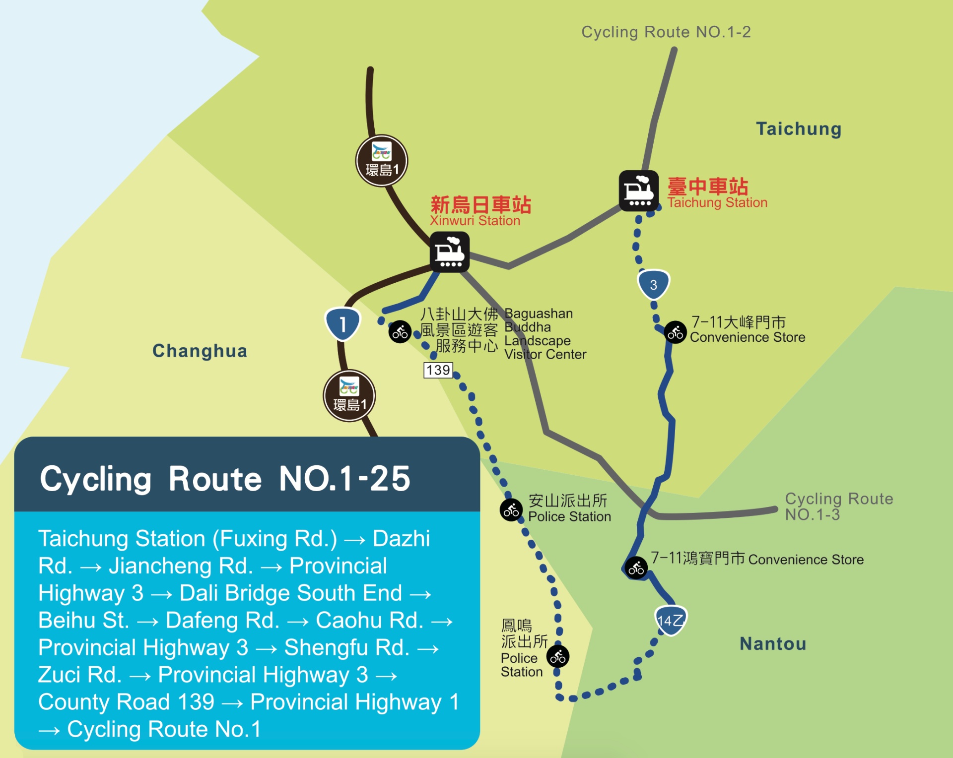
Taichung Station (Fuxing Road) → Dazhi Road → Jiancheng Road → Provincial Highway 3 → Dali Bridge South End → Beihu Street → Dafeng Road → Caohu Road → Provincial Highway 3 → Shengfu Road → Zuci Road → Provincial Highway 3 → County Road 139 → Provincial Highway 1 → Cycling Route No. 1
GPX Routes
- Garmin: https://connect.garmin.com/modern/course/139799955
- Velodash: https://velodash.page.link/oT6M
- komoot: https://www.komoot.com/tour/1032660669
NOTE: To use the routes, please install the App on your smartphone. The App will launch and load the route automatically after you tap the above links on your smartphone’s browser. For Garmin Connect, you can then use the APP to send the route to your garmin device. If your Garmin device is not purchased in Taiwan, you will also need make sure you have the Taiwan map on your device. Here is our blog post on this topic.
Disclaimer
We DO NOT own the graphic and information in this post – it all came from the Taiwan Cycling Single Portal built and maintained by the Ministry of Transportation and Communications of the Taiwan Government. This website is the authoritative source of information for all those who plan to do the around-the-island trip in Taiwan. It’s very useful, but unfortunately not very user-friendly in our opinion. Therefore, what we are trying to do here is to re-organize the information in a way that we find handy and mobile-friendly.