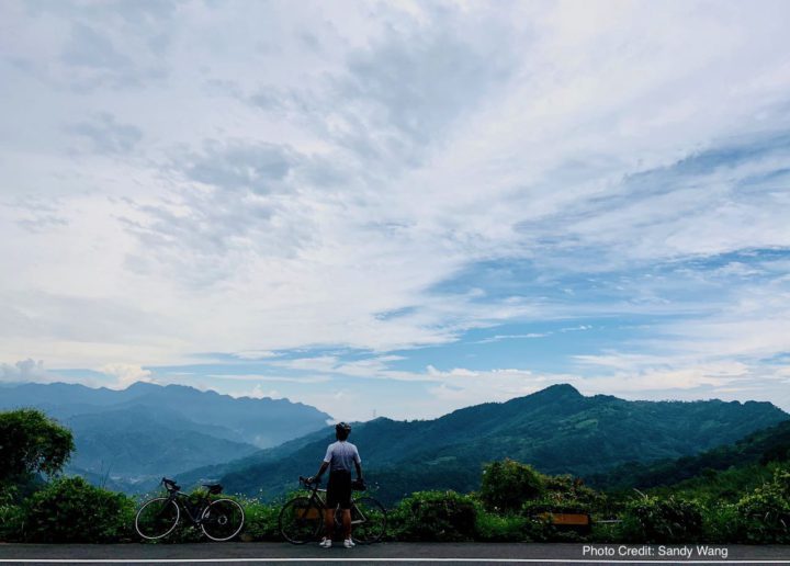
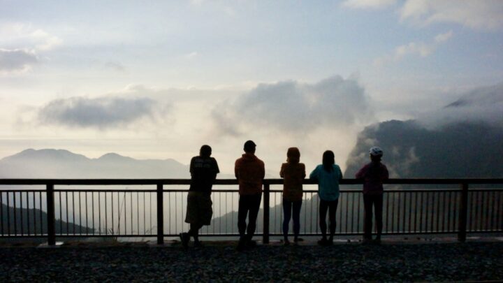
I went cycling from New Taipei’s Tucheng (土城) to Dongyanshan (東眼山; literally “Eastern Eye Mountain”) National Forest Recreation Area in Taoyuan County with a small group of friends on a Sunday in September 2020. It was a 71km loop with the maximum elevation of 913m, plotted by Sandy Wang, a cycling enthusiast. The starting point, and also the end point, is at the southern terminus of Taipei Metro’s Blue Line, Dingpu Station.
投稿者: admin
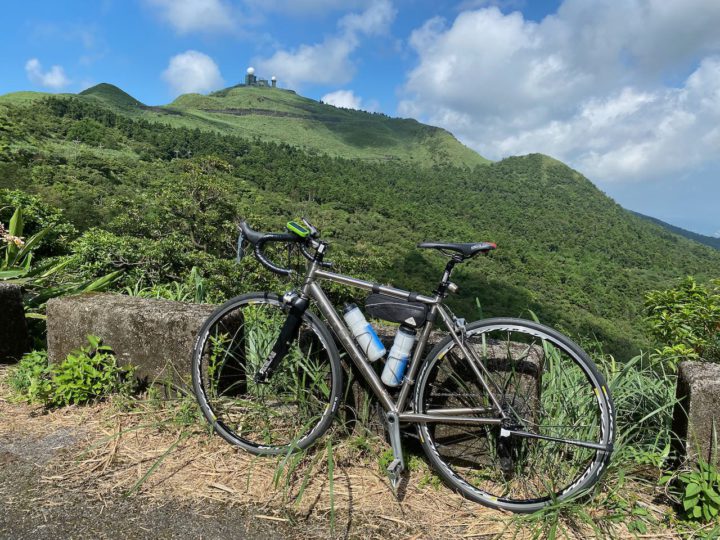
Cycling Route: Wufenshan and Buyan Pavilion – Climb Training
I went for a cycling trip with a group of cyclists in the outskirts of Taipei on a Saturday in mid June. It is a 67km loop with two climbs to Wufenshan Meteorological Radar Observatory 五分山氣象雷達站 (757m) and Buyan Pavilion 不厭亭 (530m).

Cycling Route: Crocodile Island – Climb Training
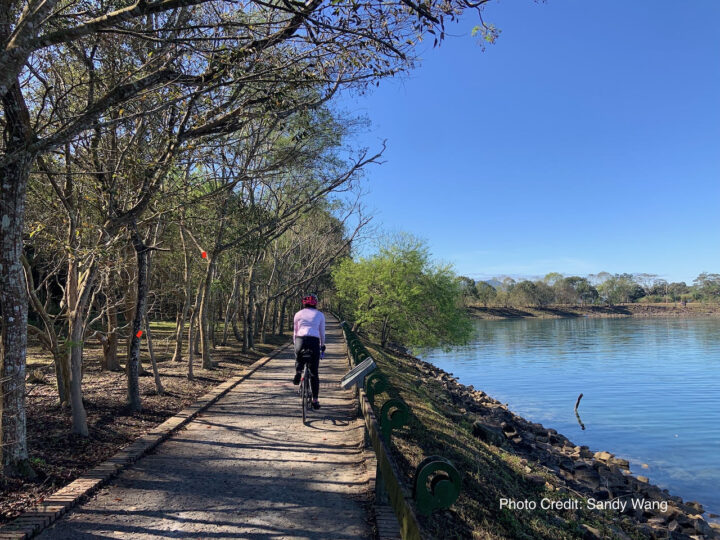
I went for a cycling trip with a small group of local cyclists on a Saturday in May, to get a good look at the Crocodile Island 鱷魚島, which can be found in the Fei-ts’ui Reservoir 翡翠水庫 in Shiding District 石碇區 of New Taipei City. It is a 41km route with a maximum altitude of 583m and an elevation gain 1871m. The route is designed by the group leader Sean Fang.

Cycling Route: Xiong Kong Tea Plantation – Climb Training
I went for a cycling trip from Xindian to Xiong Kong Tea Plantation with a group of local cyclists. It was an enjoyable 60km route with two climbs (338m, 728m), planned by one of our friends.

Step-by-step Installation Guide for SPIN UP F12W-PRO Bicycle USB Charger Dynamo
A step-by-step guide on how to install the Spin Up F12W-PRO Bicycle USB Charger Dynamo on your bike.
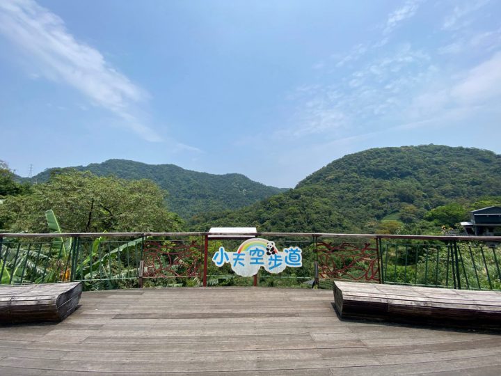
Cycling Route: Maokong Loop – Climb Training
Maokong Loop is a 13km long, single-peak (326m) cycling route in Wenshan District, South East of Taipei City. It’s a popular climb training route in Taipei.
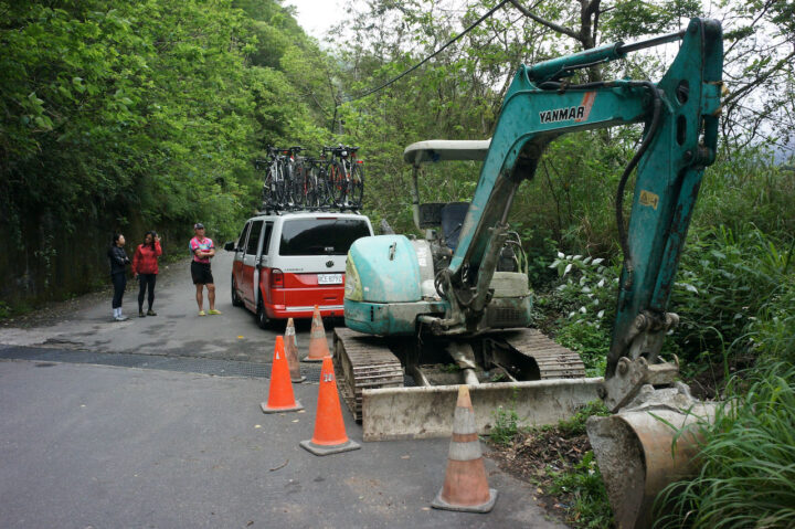
台湾のサイクリング道路状況:最新情報の確認方法
台湾でのサイクリングを安全に楽しむために、最新の道路状況を確認しましょう。地震や台風の影響で一部の道路が損傷することがありますが、台湾交通部公路総局の「省道即時路況サービス」を利用して、リアルタイムの工事情報や災害情報を入手できます。出発前に必ず確認し、快適なサイクリングをお楽しみください。
サツマイモを切り裂く – 台湾の壮大な山岳地帯を巡るサイクリング(2)
「さつまいもを裂く」の後半では、埔里から出発し、茶畑や先住民の集落を巡り、標高2,600 mの塔塔加までのサイクリングを体験します。豊かな文化遺産と美しい風景が広がるこのルートは、忘れられない冒険となるでしょう。GPXデータを提供しているので、事前に計画を立てて快適なライドを楽しもう!
日月潭へのサイクリングルート:絶景ルートと旅行のヒント
日月潭へのサイクリングルートを満喫!台湾サイクリングルート1を超えて、壮大な景色と魅力的な代替ルートを楽しもう。美しい湖畔の道や絶景ポイントを巡る台湾自転車旅行で、忘れられない旅を体験しよう。旅行のヒントやおすすめルートもチェック!
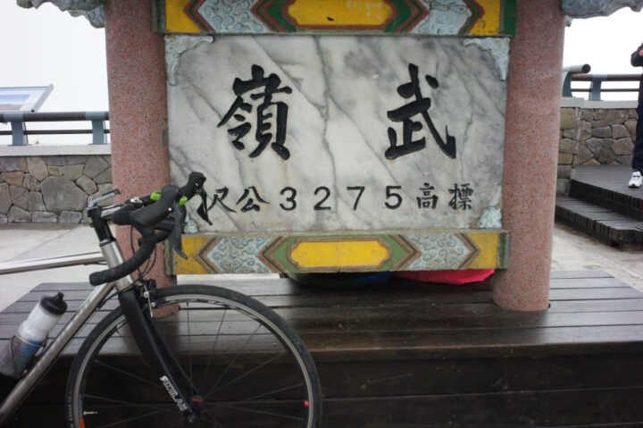
台湾五極点サイクリング:武嶺制覇への挑戦
台湾五極点サイクリングチャレンジは、北・東・南・西の四極点に加え、標高3,275mの武嶺を制覇する過酷なKOMルート。総距離1,237 km、累積標高11,143 mの壮大な挑戦!特に武嶺は台湾最難関のヒルクライムで、秋が最適な登坂シーズン。究極の台湾自転車旅行に挑戦しよう!